Warning: call_user_func_array() expects parameter 1 to be a valid callback, class 'collapsArch' does not have a method 'enqueue_scripts' in C:\inetpub\vhosts\globitrotter.com\httpdocs\blog\wp-includes\class-wp-hook.php on line 307

First outing

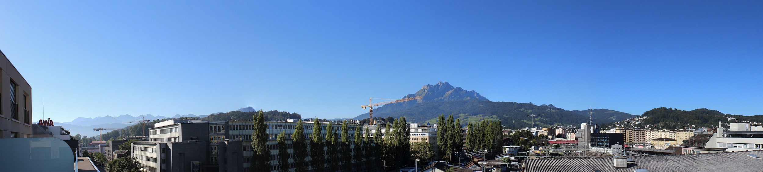
We have lived in Lucerne since 1 June and from our balcony we see the mountains, particularly the Pilatus. It is regarded as the “house mountain” being the highest peak close to the city. With its 2128 meters it is higher than the highest point in Sweden. Considering our interest in hiking it is astonishing that we have not hiked one single time since we came back to Switzerland. The weather has been fantastic so there was really no reason. But I have to admit that after doing so much hiking during our trip and moving around every day made us lazy and we have enjoyed just staying put for the summer.

IMG_8260

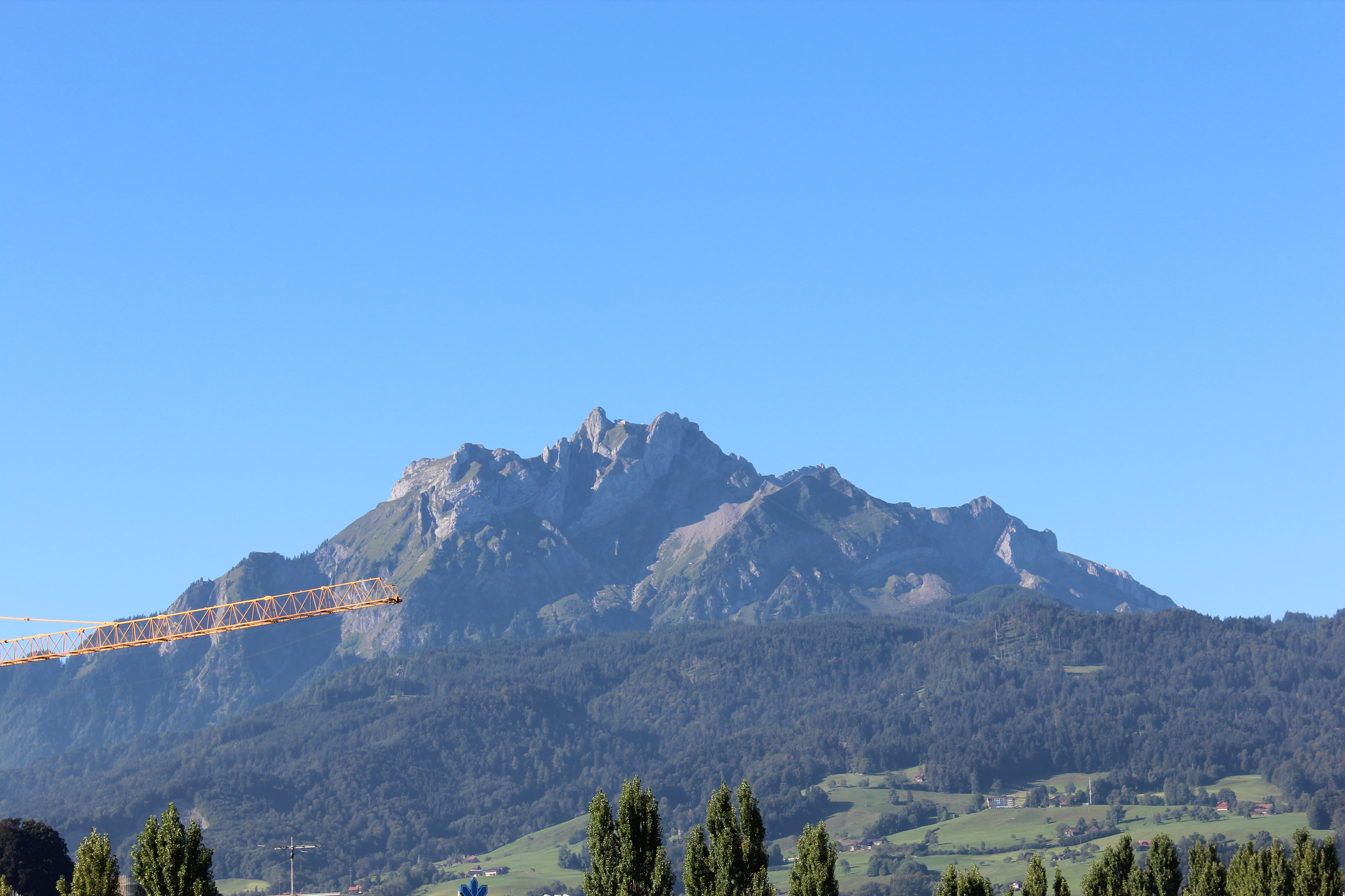
The Pilatus is very green this time of year. If you zoom in you can see the red gondolas on the right side of the mountain.

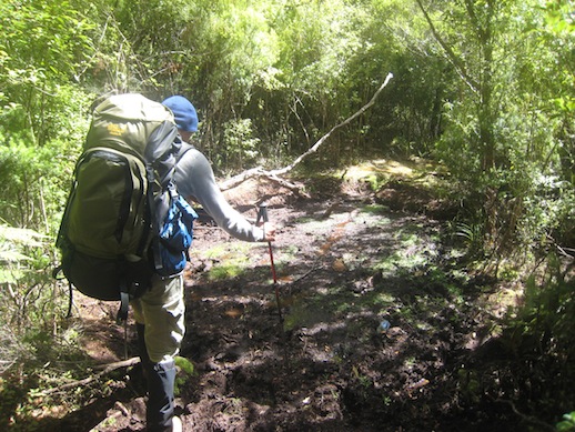
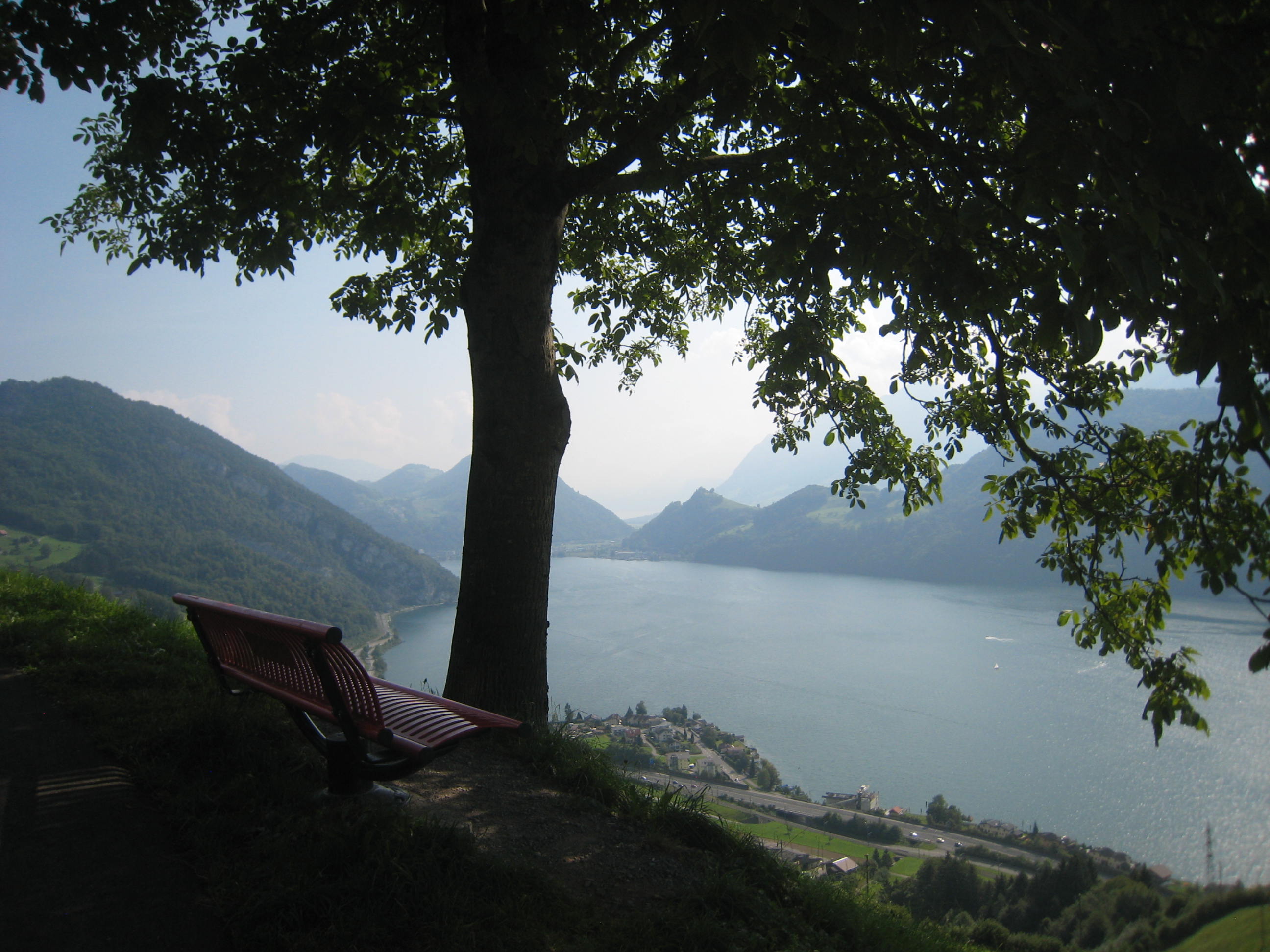
Lately though I have started to feel the urge to get up there again and on Saturday we did our first “real” hike since Tasmania in March. (I am not including smaller walks to see certain sights.) We decided to hike the Pilatus from the Alpnach side which is the most direct route and therefore also quite steep. You start at the Pilatus Bahn station (yes, there is a train going up on this side of the mountain) on roughly 450 m altitude. It starts off on the meadows but rather quickly you enter the forest and do not get out in the open until almost half ways to the top.

IMG_4255

Before getting into the forest.

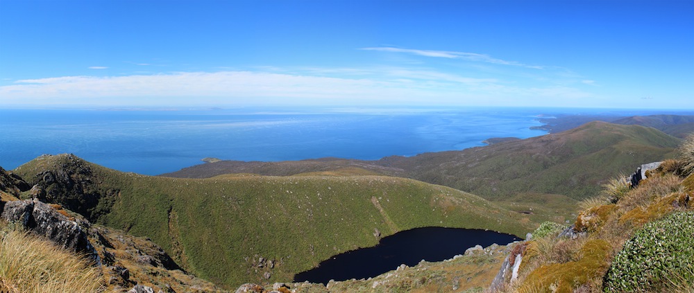
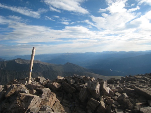
Once above the tree line you soon see your goal for the first time and it becomes very obvious that it is a fair way to go. You can see the switchbacks you have in front of you but you also have a nicer view and it is more alpine with beautiful meadows and steep rock faces. The top of the mountain was mostly covered in clouds so it did not make much sense to take pictures at this point.

IMG_4258 IMG_4259

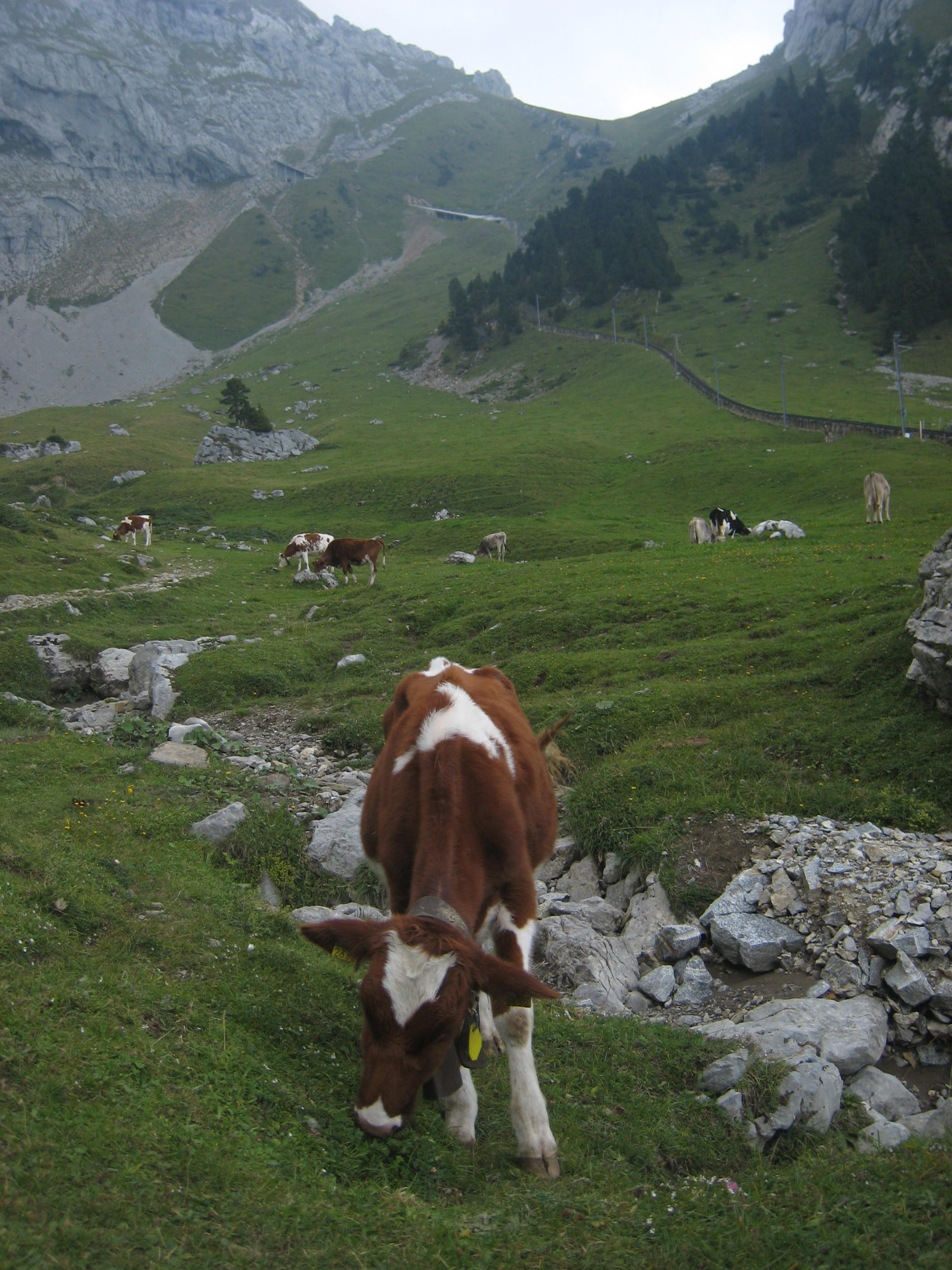
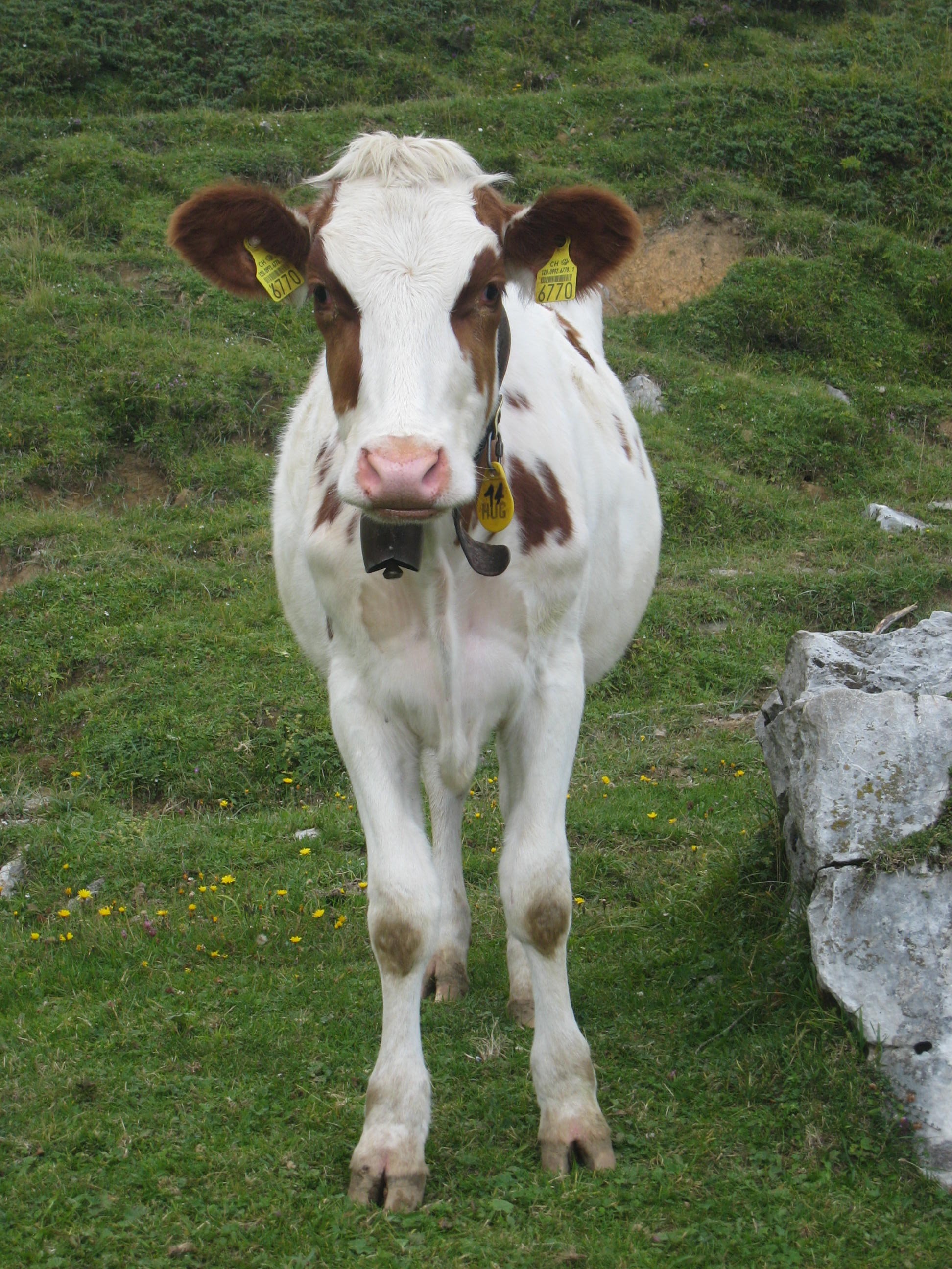
What is a hike in the Alps without cows? In the background in the left image you can see the train track.

Being not in the best of shapes it took me about half an hour longer than last time I did this hike 3 years ago. We did not keep that good track of our time, we stopped and talked to fellow hikers on the way, but I think we did the 1700 m altitude in about 3 h and 40 min. My goal is to cut that time with at least one hour. I would be happy with 2.5 h. Andy’s goal is a bit more aggressive but he would have to run part of the time to reach his 1.5 h goal…

At last we reached the peak which is crawling with people. The amount of people that actually hike up is not very large, most come up with the train or the gondola on the north side of the mountain. Recently they renovated the facilities on the top to fit even more people indoors. I guess a lot of the tourists does not realize that it gets quite cold up over 2000 m, especially when the wind is blowing. This way they can get a nice lunch or snack without having to freeze half to death.

And being out of shape we took the train down. 🙂 It is quite a cool train being the steepest rack railway in the world. They say the steepest part is 48% which is quite impressive considering it opened in 1889.

IMG_4276

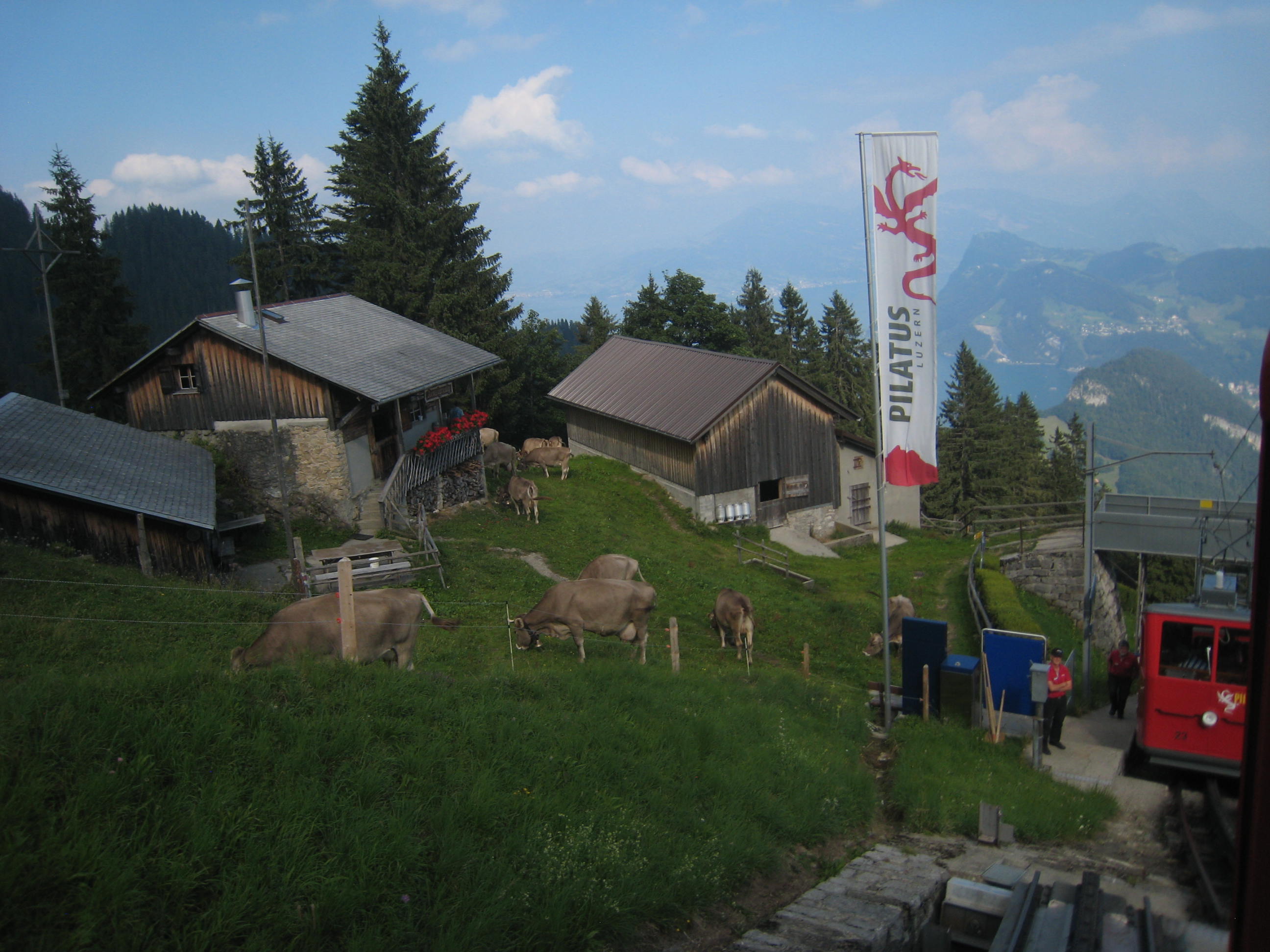
This is the half way station. You can get off and on here if you don’t want to do the complete hike or just get off, stroll around, say hi to the cows and then continue with the train.


The greatest Great Walks (Milford, Routeburn and Kepler)

In the Fiordland area in the southern part of the South Island you can find the three most popular hikes in New Zealand. The Milford Track being the most popular closely followed by the Routeburn. The Kepler was created not too long ago to let some pressure off especially the Milford. I am not sure how well this worked considering you still have to book the Milford Track half a year in advance to be sure to get a spot. The Kepler is normally the track people end up doing if they have not booked in advance.

Milford_Panorama_2_a copy

MacKinnon Pass on the Milford Track

Being a keen hiker and researcher I of course booked the Milford already in July last year so our spot was safe. There are usually cancellations so if you have not booked you can still get lucky but would require checking the booking site everyday which is not what I fancy on a holiday. At the time of booking I did not realize we would do as many hike as we have. Now we have done 8 multiday hikes and a few day hikes including all of the three above.

The hikes mentioned above are also the most expensive ones costing 54 NZ dollars per person per night. This is the same price as a standard motel room but here you have to share more or less dirty kitchens, toilets and sleeping quarters with snorers and people with no respect of others. I understand that they do charge this much considering how hard it is to maintain tracks and huts in this environment. But being on holiday and wanting to do a lot of hiking it unfortunately quickly becomes very expensive.

IMG_5868_a copy

One of the many waterfalls on the Milford Track.

Partly because of the price but even more because the recommended times on the Great Walks was becoming too easy and tedious for us (spending too much time in huts is simply not comfortable or fun enough in the long run) we ended up doing these three tracks in different ways. In the Milford case we didn’t really have a choice, you had to spend one night in each hut. They let 40 people start the track every day (on top of that there is the guided walk) and you are only allowed to go in one direction in high season. So the Milford was an easy hike, 3 nights and not very strenuous. We had lots of time on the track which in our case was perfect because Andy had some problems with his knee and by the end of the track he was basically fine again. This track requires ferry transport at each end and bus to take you back to square one which also makes it the most expensive one.

IMG_3708_a copy

Part of the ridge on Kepler.

Andy’s knee problems originated on the Kepler Track which we did faster than recommended spending only one night on the track instead of two or three. This meant two longer hiking days, 30 km each. Due to Andy’s knee, which started to give him trouble on the second day, we cut that day short at 20 km and caught the bus the remaining 10 km. I had thought this hike would be very strenuous with two long days including about 1700 m total elevation but it turned out not to be so bad. Maybe we are getting more fit after all. 🙂

IMG_3903_a copy

On top of Conical Hill on the Routeburn Track

The Routeburn Track which was the last of our hikes we decided to do as a day hike, or at least two thirds of the track. The complete Routeburn in one day would have been easy being only 32 km. But the problem is that it is a one way trail and you have to get transport from the finish back to the start which is a 4-5 hours drive. So we decided to hike the most interesting part over the Harris Saddle, down to Lake Mackenzie and then back again. Meaning we managed to make a 32 km hike into a 42.5 km one because we wanted to get back to the point we started. This was a bit more strenuous than anything else and our bodies needed a day or so to recover.

As for the tracks it is hard to say which one is more beautiful because they are a all a bit different. The Milford has the most variety with its streams, waterfalls, steep valley sides, the mountain pass with good views, forest and boat rides. It is known at “the greatest walk in the world” for a reason, it is really nice. However if what you are after is a more alpine experience the Routeburn with better views (especially if you climb the Conical Hill), alpine lakes, nice forest and streams might be to prefer. The Routeburn still has a lot of variety and more time above the tree line with good views. The Kepler, which is a bit of a favorite for us, has the best views and a trail along a long ridge (I love ridges). However the forest is not as nice and it misses the streams and waterfalls. But that ridge is worth it! Actually I would recommend hiking the ridge over to the hut on the other side and then going the same way back the next day instead of doing the complete loop. That way you have a better change of getting good weather on the ridge.

You can decide for yourself which is your favorite by looking at the images below:

Milford Track
Routeburn Track
Kepler Track


The challenge – North West Circuit on Stewart Island

After hiking a number of Great Walks we started to feel we needed a challenge. The North West Circuit on Stewart Island would definitely be the longest and hardest trail we have ever done and most probably ever will do. The fact that this is the place where you have the best chance of spotting kiwis was another reason for going. The route we chose was in total 132 km and almost 5000 m elevation including the highest peak on the island, Mt Anglem. The trail is not maintained like the Great Walks and features lots of roots, steep slopes and mud. We had read a lot about knee deep mud all along the trail and were prepared for the worst.

IMG_6233_a copy

Sunset at Big Hellfire Hut.

It had been dry weather for two whole weeks when we arrived at Stewart Island and only a few showers were predicted in the next couple of days. The hike would take 9 days so we knew that we could get any kind of weather before we were due back. A few days of heavy rain and the track would be very wet, muddy and slippery. We believe we were very lucky and had only light showers a couple of days.

IMG_3790 copy

Mud, mud, mud.

Doing the Circuit clockwise is not the usual way to do it and not a lot of people go in this direction. Reason being that the first few days will then be the longest and hardest when you still have a very heavy backpack. But we did want a challenge so off we went. It was hard the first few days but I thought it continued that way the whole time. Of course that was partly our own fault. First of all it was hard just because it was long, many consecutive days on a difficult trail. Second we decided to add a side trip on day 6. The side trip was climbing Mt Anglem which is the highest peak on the island with its 980 meters. It may not sound very impressive but the trail was even steeper, more washed out and muddier than the rest. This day we hiked in total for 9 hours and were completely exhausted in the evening. Our bodies did not seem to really recover after this and even if the remaining days were easier we felt more tired.

Pano_14_a copy

View from the top of Mt Anglem. We were extremely lucky with the weather, the only day with a clear blue sky. That made it worth the 3 hour climb to the peak.

Before we started I was mostly worried about the mud and the length of the track. What I ended up thinking was the worst was all the ups and downs, high steps and roots to climb over. It was basically very exhausting all the time. It was mentally hard to be out for so many days and after a few days we dreamed of fresh fruit and beer instead of freeze dried food and oatmeal.

IMG_6274 copy

East Ruggedy Beach.

What you see along this trail is a large variety of scenery including beaches, forest, bush, and sand dunes. We did meet a few people along the way but most of the time we were alone in this wild country which was absolutely amazing. And we did see 4 kiwis! Apart from the kiwis there are lots of cool birds on this island like red crowned parakeet, robins, wood pigeons and fan tails. Although it was hard work it was worth it and very rewarding in the end.

IMG_6442 copy

Sunrise at Bungaree Hut.

First thing I did when we came back to Oban was to order a big salad for lunch. Wonderful with fresh food! In the evening after a long hot shower we went for hamburgers and beer. 🙂

More photos:

Stewart Island – North West Circuit

The stats:

Tongariro Northern Circuit

You might have heard of the Tongariro Crossing, one of the most wellknown day hikes in New Zealand, which is a part of the Tongariro Northern Circuit. The track is about 45 km and we decided to do it in 3 days. The first day was very short, just a few hours to the hut and basically no elevation gain or loss. When we started the weather was a bit unstable but as we woke up the second day the sky was blue.

IMG_3073 copy

The view from the first hut with Mt Taranaki at the horizon.

From the track we could see the snow capped Mt Taranaki at the west coast. The second day started along the Tongariro Crossing which meant it was full of people. It looked like an ants trail and we were happy it was only a part of our hike that was going to be that crowded. Tourists are generally not very well equipped and on a tight time schedule. This means anything that involves an over night stay without hostels or hotels available will be relatively empty and mainly filled with locals.

IMG_3110 copy

Following the ant trail on the Center Crater.

After an hour or so hiking we found ourselves at the foot of Mt Ngaruhoe (featuring as Mt Doom in the Lord of the Rings trilogy). We had not really planned to climb the peak because we thought there would still be too much snow on the top and that it would be too much for one day. We were going to skip one hut and go to the next one which added a couple of hours to an already full day. But we had seen that the snow had melted and although it was going to be hard we could not resist the temptation.

IMG_3078_a copy

At the base of Mt Ngaruhoe

IMG_3089 copy

On the peak.

Mt Ngaruhoe is an active volcano which is an almost perfect cone. It might not look so bad from a distance but it is very difficult to climb with loose rocks and steep slopes. It did not make it easier with the big backpacks but within 1.5 hours we were on the top and could enjoy the views while having lunch. There are quite a lot of people climbing the peak which is dangerous because of falling rocks. The day before we hiked one guy had to be pick up with helicopter after being hit by a rock. We made it though without injuries and could make our way towards the hut.

IMG_3118 copy

Emerald Lakes which we passed on our second day.

Finally around 6 o’clock in the evening we made it to our hut which was newly opened and had great views of the Mt Ngaruhoe. We just barely made it through dinner before we fell a sleep exhausted after another great hiking day.

IMG_3133_a copy

The view of Mt Ruapehu which we saw a lot of the last day. The trail ran between Mt Ruapehu and Mt Ngaruhoe making it a very beautiful part of the track.

The last day was fairly short and easy with not much elevation gain. We made it back in time to have afternoon tea in the Chateau at the end of the track with Anna and Basti that we had met along the way. A very nice ending of a beautiful hike in volcanic surroundings which are not very common in New Zealand. Usually a great part of the hikes are through forest but this one only has about 30 min of forest in three days.

IMG_3161_a copy

Afternoon tea with a view of Mt Ngaruhoe. What an excellent end of a great hike.

Click the image below and you can see more photos from the hike.

Tongariro Northern Circuit

To hike a 14er

By now we have been on the peak of half of the 55 14ers in Colorado. You might wonder why we have to climb that many. Once you have hiked a few you get hooked and want more. Although they are all about the same height they are all different. The hike itself can be easy walking or partly technical climbing. There are usually several ways up a 14er and we have chosen both easy and harder routes. The harder ones are the favorites since they feature less people and more fun. The view is different on each peak even if they sometimes are very close to each other. Sometimes there are green rolling hills around, sometimes rugged ridges and rock faces. The crowd is always different, you might be alone on the peak or trying to find a spot to sit down among dozens of people.

Below is a photo album from this years adventures in Colorado.

Since there are many thunderstorms in the mountains this time of year it takes some planning to avoid getting stuck on a peak when lightning strikes. According to our experience the clouds starts forming around 10 am and usually the first rain starts somewhere between 12 and 2 pm. We do not like hiking in rain so naturally to avoid it we get up very early in the morning to make it to the top when the sky is still blue and start heading down when we see small fluffy clouds that in no time will transform into dark rain clouds. This means that for a longer hike where more peaks are combined or there is a very long approach we start hiking before 4 am. Just after 5 am it is light enough to hike without a head lamp and usually the first part of the hike is not so difficult to find. Another good thing about starting early is that it is cool and very nice hiking temperature. For easier hikes we might not start until between 6 and 7 am.

On the trail as the sun is rising. (Mt Bierstadt)

The weather seem to be something that people does not care much about until they are in it. We are usually among the first ones on the trail. Does people not read the weather report? Have they not seen what the weather has been like the past weeks? It is always the same according to our experience. On basically every peak most people will barely make it to the top to get a good look at the view before the clouds roll in. These people will most probably get caught in the rain coming down but will at least be off the peak before the thunderstorms hit. Then there is always the guy we call the 11 o’clock man (or woman). Usually this is one person hiking alone who starts heading up the mountain around 11 am as we are almost down again. He will definitely not make to the top before it starts raining and will have to turn around without even reaching the peak unless he wants to risk getting hit by lightning. This must be very frustrating, going through so much for nothing. We are equally fascinated every time.

It is very obvious which are the popular peaks and not. On a few peaks we have been alone, maybe meeting a few people on the way, and on other there have been crowds. The popular ones are naturally those where you can reach a trailhead with a normal 2wd car and still do not have to hike too far. It is amazing though what people put their 2wd’s through to reach a trailhead. We saw one very sporty car, probably even lower than the original model, on a very obvious 4wd trailhead. He must have damaged his car driving to and from this trailhead. Is it worth it?

One of the more popular peaks, Grays Peak.

Clothing is another interesting thing. I think it is quite cold on a 14er, the wind is usually strong and the air cold. I could not make it without long pants and long sleeves, usually a windstopper on top of a long sleeved and a short sleeved merino wool shirt. The most Americans though are wearing short (for girls usually very short) pants and often tank tops or t-shirts. My body would scream and refuse to work if I would wear that. I can not possibly hike fast enough to warm my body during these conditions. Maybe on the peak they will put a thin wind jacket on before they hurry down again after taking the obligatory peak photos. It was very obvious as we were hiking Mt Shavano. A lady started just after us and had about the same pace. As the sun came out we stopped to put on sun block on our faces and put on a extra jacket because we were now above the tree line and the temperature had dropped and the wind was chilly. She stopped at the same time, also to put sun block on but she also took her jacket off and zipped off her pants! Does the American bodies work differently or are we just incredibly cold??

The summary is that we can only warmly recommend hiking 14ers in Colorado. It is a beautiful and friendly area with peaks that will fit everybody.