Warning: call_user_func_array() expects parameter 1 to be a valid callback, class 'collapsArch' does not have a method 'enqueue_scripts' in C:\inetpub\vhosts\globitrotter.com\httpdocs\blog\wp-includes\class-wp-hook.php on line 307

Zion National Park

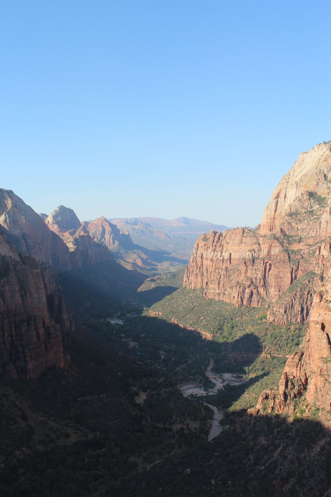
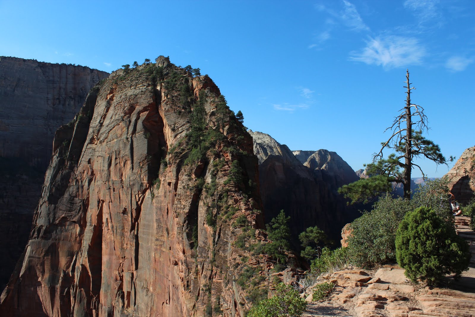
View over Zion National Park from Angel’s Landing

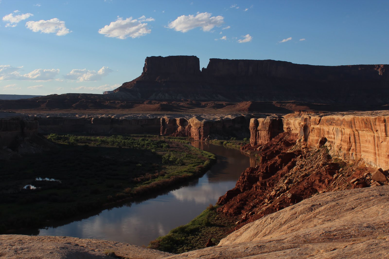
As we drove into Zion National Park we realized that we were getting back to desert temperatures. It was suddenly very hot again and it was hard to sleep at night. You can’t really have the engine running all night for air condition… Bryce had been warm during the day but fairly nice due to the elevation.

The heat was a factor when we chose the hikes to do here. We decided on Angel’s Landing as early in the morning as possible and Lost Canyon which was a short hike in the shade most of the day. It turned out to be a good decision and we had time to get out in the afternoon and have coffee in an air conditioned café, a swim in the cold river and a beer before cooking dinner.

You have to hike this narrow ridge to reach Angel’s Landing
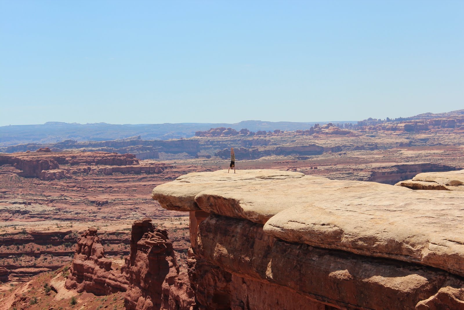
Fun stuff!

Overnight hike in Bryce Canyon

Bryce Canyon

In Bryce Canyon we decided to do an overnight hike. We caught a lift with the tour bus to the south end of the park and hiked back to the more popular area closer to the entrance of the park. As we came to our final stop the bus driver told the other passengers, mostly overweight older americans, that he wanted to say goodbye to the two hikers and wish us a nice hike back. As we were leaving the bus the other passengers expressed their admiration and best wishes, it was obvious it is not very common to do a longer hike in this park.

At the starting point.

Before heading out you need to get a backcountry permit and reserve a spot at one of the few campgrounds along the way. We chose a camp about half ways after we added a loop of about 14 km in the south part of the park. Afterwards we realized that the loop had not been necessary to do since it was mainly in the forest without any view. It mainly just added time and effort. What we did see though were a lot of cute horned lizards, actually 19 of them. We had seen one in Arizona earlier this year and got the feeling they are rare to see but here they were everywhere.

Horned lizard

As we got our permit they also gave us a bear vault. This is a box with a lid that is bear proof in case one happened to find us and decide to try and steal our food. In the box we had to keep all food and scented items, like tooth paste. We also got very clear instructions on how and were to cook, sleep and go to the bathroom. We believe we followed the directions which should ensure that the park is kept clean and bears away from the tourists. They have had to put down two bears because they were stalking tourists looking for food. This is what happens when people leave food at campsites. Luckily we were not stalked, we only saw the foot prints of a mountain lion in the morning. We were ok with that.

Cooking dinner. Bear vault to the right.

Most of the hike was down in the valley underneath the rim which Bryce Canyon is so famous for. The very first part going down from Rainbow Point and the very last part coming up to Bryce Point were the nicest ones. On the way the trail went up and down a number of hills which turned out to be quite strenuous. The hike was in total about 50 km so we did about 25 km per day which is probably about what I can take with a heavy backpack and elevation change. We made it though and looked forward to shorter day hikes for the rest of the holiday.

Coming down from Rainbow point

Needles – an unexpected adventure

After some breakfast in our favourite café in Moab we drove south towards Needles. The Needles is a part of Canyonlands National Park and since we already had a backcountry permit for this park we thought we should drive in and have a look.

This is what we did NOT read before driving happily along and now we also understand why the park rangers wished us good luck…


So, we did not know that we were about to drive one of the hardest trail in the state although it was written on our map, on the flyer we got at the ranger station and on the big board as you start the drive. We simply did not read it… Maybe sometimes it is good not to know everything.

We just wanted to drive in, hike a bit and camp somewhere in the park and then leave the next morning. It turned out being quite a drive with one of us most of the time in front of the car spotting the best way to go. We knew that the car was capable of a lot but we did not really want to try it out because we did not want to break it. Now we know more.


We made it through without any damages to the car, but next time we will probably hike into the area and leave the poor car safe on the paved parking lot. Once we reached our camp we went for a hike and it was all worth it because this is what we saw.


The fact that the hike was longer than we expected (our mistake again), that we had to hike the last hour or so in the dark (luckily we were clever enough to bring head lamps), that we lost the trail for a short while and were hungry and tired is something we don’t really remember anymore. Somehow it is almost always worth it.

Arches National Park

After a well deserved shower and over night stay at a camp ground we were ready to take on Arches National Park. We started with some coffee at a café in Moab before heading out to the park which is very close to town.

The first target was Delicate Arch which the park is probably most known for. It is a maybe 20-30 min hike to get to the arch, which is not too much but the heat makes it fairly tiring. We had checked the weather which said possible rain and thunderstorms in the afternoon so we did this hike first although the light for photos is better in the afternoon. With some tricks we still got a cool picture.


Next stop was Devils Garden which was a bit longer hike but featured some very nice views, arches and some rock hopping. The trail was a lot more fun here but we ended up in the middle of a sand storm so we had to rush back after half the trail. We met many tourists on their way into the area as we were coming out. Many with their SLR cameras in their hands trying to take pictures in the sand storm. The wind was very strong and you could feel the sand between your teeth. I expect some of them having to bring them in for cleaning afterwards. We had packed ours safely in the camera bag.


White Rim Road – Utah


Almost ten years ago I stood at Grand View overlook in Canyonlands National Park, looking down over Colorado River as it meanders through the canyons. Halfways down I saw a trail following the white rim and I thought that some day I want to drive that road. A few days ago we drove down the Shafer Trail that took us to White Rim Road and exactly where I wanted to go.

The Shafer Trail is a steep trail with a series of switchbacks that takes you down to the white rim level. The trail then takes you along the rim in a very desolate area. There are a few camps along the trail but the number of visitors are limited and it is a quite long and bumpy ride so very few day trippers go that far. We spent two nights on the trail and saw very few people, only as we were entering the area and leaving again. Unfortunately the end part of the trail was blocked due to heavy rain so we could not drive the entire loop but had to go back the same way we came in.

The cool thing about the White Rim Road is the fact that it is isolated and you feel like you are the only people in this moon like landscape. At one spot you can look up to the Island in the Sky and see the tourists at the look out point looking down at you. Otherwise there is no sign of civilization at all. Luckily we brought some extra gas because we would not have made it back on only one tank of gas. And of course the beers we brought were also important. What else is there to do in the afternoon when you have reached your camp and it is still almost 40 degrees… 🙂

Green River at sunset from our second camp site.

The white rim is white sand stone that runs along the canyon. At some spots you can walk out on the rocks and look down towards the river.

After two and a half days of driving mostly 20 mph due to road conditions it was nice to get out on the paved road again. It is fun to drive on this kind of trails but it is usually enough for a few hours. The picture shows an example of what it can look like and although it looks quite smooth it is fairly bumpy.

In this park we saw a few long horn sheep along the way. This one looks particularly cute.

Denver


We did not have a lot of expectations as we drove into Denver after almost two weeks in the mountains. At first it did not look very impressive but as we drove through the city center we were convinced. Denver actually has what we miss in Phoenix, a city center where people spend time, where there are restaurants, bars and cafe’s. On a Friday night people are walking the 16th Street Mall watching other people, street performers and shop windows. We immediately liked the city and nominated it to a favourite US city. We could live here. The problem now is that we don’t really want to go back to Phoenix…

Very close to the center we found this little park.

Only in America…